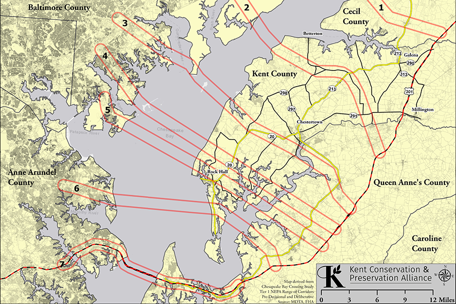
Proposed Bay Bridge Crossing Options in Kent County
This map of the proposed crossings is based on the Maryland Transit Authority’s Pre-Decisional Maps that were unintentionally released in February, 2019. To view the original Maryland Transit Authority’s maps follow the link. >>>Original MDTA Crossing Map
To view this map in more detail, click or tap on the map. The map will open in a new window. Look for the +/- boxes boxes in the upper left of the screen or use your wheeled mouse over the image to enlarge or reduce the size of the map. When you zoom in you will be able to see the land parcels that could potentially be in the path of the proposed crossings.